Research
Ever-evolving ideas aimed at solving physical phenomena of rivers and deltas, while contextualizing them environmentally and stratigraphically. Here are some recent and ongoing research localities and projects. New ideas are always welcome!

We are focused on evaluating the geomorphology of rivers in peatland bogs, which are found in environments that cover both high- and low-latitude settings on earth, from the interior of continents to coastal landscapes. Our research includes using targeted and detailed measurements from peatland streams to inform physics-based models that are used to evaluate the evolution of these systems over time and space. This work has important application to humans and the environment: while covering only 2% of earth’s land surface, peatland bogs possess as much as 40% of its organic carbon. The dynamics of peat streams therefore have significant potential to affect the carbon budget between earth’s land surface and its atmosphere. Moreover, as climate change fundamentally reshapes hydrology of peat systems, the numerical models under development will be critical to constraining the dynamic behavior of peat streams. For example, the potential for increased rates of lateral migration to erode and therefore liberate significant quantities of stored vegetal carbon that comprises the floodplains of peat streams. Additionally, the storage capacity of floodplains to acquire peat. Our research efforts are at the leading edge of geomorphology and climate science.
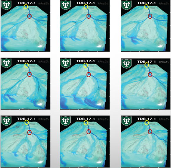
We are investigating river avulsions – the process by which rivers rapidly (and often catastrophically) jump their banks in search of a new channel across earth’s surface. These events are rare (thankfully…), and so our research approach includes using advanced experimental methods with our collaborator, Prof. Kyle Straub (Tulane University). Here, we have conducted a series of designed experiments with the purpose of documenting (measuring) hundreds of avulsion events for controlled conditions in a large experimental tank. The aim is to evaluate how new (nascent) channels evolve during an avulsion event. The data are used to develop novel, physics-based models that shed light into how a channel grows in its area to accommodate an ever-greater input of upstream water and sediment. There are numerous applications for this research, from basic (foundational) science, to engineering designs for river systems (which represent major transportation corridors around the world), to stability of river channels that provide water for agricultural and municipal purposes.
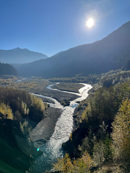
With a recent NASA grant, we are collaborating with scientists from JPL to analyze the environmental impact of river dams. The focus includes dam installation, where we are calibrating remotely sensed data with targeted field observations to assess the immediate impacts of dam construction, using the Belo Monte Dam (Xingu River, Brazil) as our study site. Additionally, we are assessing the morphodynamic response of river systems subject to dam removal, to determine how quickly fluvial systems develop equilibrium sediment transport conditions given a return to hydrological normalcy (i.e., periods of low flow and flooding), as well as access to a significant supply of sediment deposited in the decommissioned reservoir. For this part of our study, we are using the Elwha River (Washington State) as our study site. One interesting aspect about dams is that they are both installed and removed across the globe regularly. Yet, full environmental impact studies have not taken advantage of the numerous advanced observational devices available via satellite platforms. Our aim is to build robust models that leverage both detailed ground measurements and remotely sensed data to determine the time scales of environmental adjustment to both dam installation and removal.
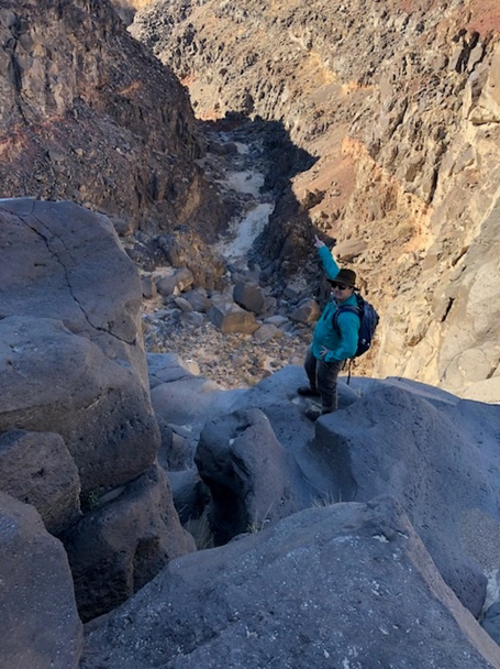
With a National Science Foundation RAPID grant, we are using the record-breaking flood of August 2023, generated by Tropical Storm Hilary, to investigate and observe directly the immediate aftermath of the type of event that shapes the morphology of arid canyon and basin systems. This work will improve an understanding of how arid canyons in the Basin and Range Province (and globally) form, extending back to at least the end of the Pleistocene. This research dovetails with recent in numerical models that seek to constrain the morphodynamic development of incised valleys, and therefore will prove invaluable for generating additional insights into water-driven desert geomorphic processes. For example, modeling the incision and morphodynamics of canyon systems developed in arid (desert) environments requires estimates of the rather rare floods conditions that activate the system. Presently, very limited data exist to constrain flow discharge and sediment mobility during rigorous rainfall events. We are pursuing field surveys that will provide us with means to constrain flow discharge and sediment movement in Rainbow Canyon, from its head to its outwash plain. These boundary conditions are critical for constraining mechanistic models used to estimate timing and rate of incision of canyons, as well as sediment deposition in the adjacent valleys.
The Huanghe (Yellow River) delta, China, is one of the most dynamic and heavily urbanized coastal landscapes in the world. We aim to utilize the ancient record of human-landscape interactions and an unrivaled pace of present-day fluvial dynamics to inform frameworks for the management of river and deltaic landscapes globally. Science here includes integrating field observations and numerical models, to evaluate fluvial-deltaic and landscape development. Because the Huanghe carries an exceptionally high sediment load, the drivers of change for this system are internal, so that boundary conditions of the basin exert minimal influence of the stratigraphy. This project is a multi-investigator, cross-disciplinary and integrative effort that includes researchers from around the world.
The Huanghe River in China
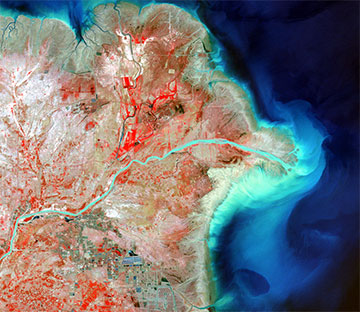
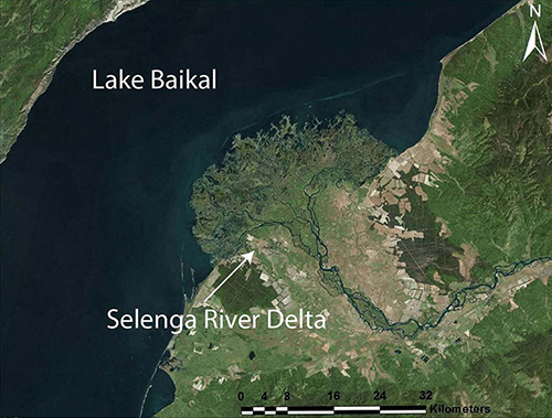
The sedimentary dynamics of active rift-basin margins are rarely evaluated based on studies from modern dispersal systems, despite the abundance of stratigraphic information regarding these systems preserved in the rock record. The Selenga River delta of Lake Baikal (Siberia, Republic of Buryatia, Russian Federation) provides an opportunity to evaluate the interplay between sedimentology and tectonics for shaping fluvial-deltaic stratigraphy. Here, a 30-million year old shelf-edge deltaic system has produced > 9 km of sediment deposit. We are analyzing hydrology and sediment transport across the topset and foreset of the Selenga River delta to evaluate how sustained tectonic subsidence influences sediment transport and the preservation of deposits. This project represents an excellent opportunity to evaluate the interplay between internal and external (i.e., “autogenic” versus “allogenic”) drivers on the production of fluvial-deltaic stratigraphy.
The Western Irish Namurian Basin (~ 310 m.a.) is considered to be a shelf-edge deltaic system, with sediment transport connections between delta and deep-water deposits. Our aims here are to evaluate the physical processes of dispersal across the wide-range of sedimentary environments preserved within this basin, and evaluate linkages to the stratigraphy of the system. This information helps inform about the importance of sediment transport processes in modern systems, by identifying the strata signatures of adjusting morphodynamic conditions pervasive in all sedimentary basins.
Western Irish Namurian Basin
Our work on the Texas Gulf Coast evaluates sediment dispersal, accumulation patterns, and delta dynamics. Research efforts include evaluating the role of large woody debris for damping wave stress and helping preserve the Brazos River delta. Additionally, numerical modeling efforts have explored the interactions of Holocene sea-level rise and hydrodynamics for the Trinity River system, which provides a natural laboratory for linking fluvial morphodynamics to stratigraphy produced by sea-level rise, because the sediments occupying the Trinity incised valley are well-constrained in terms of timing of deposition and facies distribution.
Sediment transport properties are intimately linked to hydrodynamics, so it is only natural to evaluate how properties of water discharge vary in time and space across a fluvial-deltaic system. With its exceptionally low river slope, the Mississippi River possesses a long (> 500 km) reach where water flow velocity decelerates during low and moderate water discharge conditions. This “backwater” effect has important controls on the transport sediment, both for grain size and style (e.g., bedload versus suspended load). Our group focuses on evaluating the movement of sand from the delta apex to the distal channel edges found in the Gulf of Mexico. This work has important implications for efforts to restore the deltaic wetlands of Louisiana, via controlled water and sediment diversions to the surrounding topset.
Active learning strategies improve student exam performance, engagement, attitudes, thinking, writing, self-reported participation and interest, and help students become better acquainted with one another[1]. Our research group is committed to using active learning approaches in the classrooms we lead. In particular, we are developing a comprehensive suite of interactive computer-based activities for sedimentology and stratigraphy courses (https://github.com/sededu/sededu).
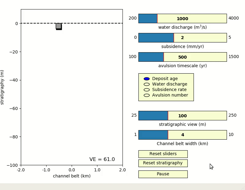
The figure above is the rivers2stratigraphy (https://github.com/sededu/rivers2stratigraphy) activity, which illustrates basin-scale development of fluvial stratigraphy through adjustments in system kinematics including sandy channel migration and subsidence rates. The activity allows users to change these system properties, so as to drive changing depositional patterns.
[1] Prince, M. (2004). Does Active Learning Work? A Review of the Research. Journal of Engineering Education, 93(3), 223-231. doi: 10.1002/j.2168-9830.2004.
Sedimentology encompasses the study of modern and ancient depositional systems, to evaluate the transport of sediment and production of stratigraphy. This information has application for evaluating rivers, deltas, coastal, and marine environments.
Department of Geosciences
Science Building
1200 Memorial Circle
Box 41053, Lubbock, TX 79409-1053.
Phone: 806-834-6550